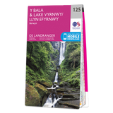
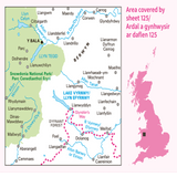
Bala & Lake Vyrnwy (inc. Berwyn) map - OS Landranger 125
The OS Landranger Map is the ideal map for planning the perfect day out. Whether visiting town or country, a wealth of visitor attractions, including National Trust properties, museums, gardens, golf courses and castles, are illustrated. The 1:50k scale mapping provides an ideal compromise between detail and coverage whilst still retaining topographical and contour properties.
Includes:
- Snowdonia National Park Llwybr Ceiriog Trail
- Upper Ceiriog Way - Llwybr Ceiriog Uchaf Pererindod Melangell Walk
- Ann Griffiths Walk
- Glyndwr's Way (National Trail) Powys
- Gwynedd
- Clwyd Y Bala
Features and Specifications:
- Scale: 1:50,000
- FSC Certified
- 100% recyclable
- Sustainable packaging


